
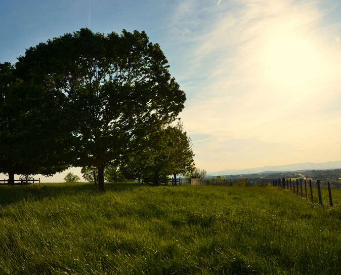
Clark Hall is the local historian for matters about the War Between the States, much of which happened right here in Culpeper. He has documented the astonishing amount of violence that happened in the tranquil rolling hills around Refuge Farm. I am traveling today and am going to borrow his words about the place I now call home, and where I will be spending a lot of the time left to me in this world.
It is a nice place. Peaceful. But in addition to being a magnate for Soviet ICBMs when the Federal Reserve was located just up the lane, this place attracted armies.
Clark notes that the Civil War came to Culpeper in February of 1862- the first full year of mass carnage in North America. General Joseph Johnston’s Confederate army transferred into the County from their prior defensive lodgment on the banks of the Bull Run in Prince William County.
From that point onward, Mount Pony was utilized almost continuously as a signal station by both armies for the rest of this long and brutal war. At 791 feet in elevation, Mount Pony is of course not the tallest peak in Culpeper—that claim is held by Bald Mountain at 980 feet way out in the Gourdvine Neck.
So, not being the largest Culpeper peak, why did Mount Pony become the most important military signal station in the entire Civil War? As a real estate professional might today respond, the key to its military significance rests in Mount Pony’s, “Location, location, location…”
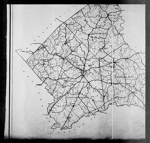
As a large map of Culpeper County is unfolded, one discerns a triangular mass of land shaped somewhat like a piece of pie. At the top edge of the pie piece, the Rappahannock River courses southeast. The Rapidan River delineates the bottom slit of the pie wedge, and this waterway tracks in a northeastern direction to where it converges at the point with the Rappahannock, near Culpeper’s eastern border. At the rear of the “pie piece,” rests the piecrust, to wit, the lofty summits at Culpeper’s western border leading up to the Blue Ridge Mountains.
Now with this local geography lesson in mind, gaze back upon your map. One thereupon observes a mile and a half-long ridge situated in the lower center of the county that tracks east-west fronting and overlooking the flat approaches, north and south, leading up from the Rappahannock and Rapidan Rivers. Not quite equidistant from both rivers (but close), Mount Pony lies ten miles from the former and six miles from the Rapidan. Vigilant Signal Hill scouts could and would immediately discover any army deploying in Culpeper from the usual north-south river approaches.
Adding to the ridge’s preeminent topographical significance, the major east- west road of the day (Kirtley’s Rolling Road, Rt. 3) defines Mount Pony’s northern base and the principal north-south road of the era—the Carolina Road, present-day Rt. 663—intersects with Kirtley’s at the important wartime village of Stevensburg, just beyond the ridge’s eastern slope .
Last, but not least, Mount Pony directly overlooks the shire town of Culpeper County, as well as the vital wartime Orange and Alexandria Railroad, just to the west of the summit.
In point of fact, Mount Pony, or Signal Hill, became the signal station most often utilized, for a greater duration of time during the Civil War than any similar signal position in any theater of action simply because the ridge was in the right place at the right time.
Indeed: location, location, location…
We’ll leave the last word on this rumination to a signalman from Maine, a sergeant in the Signal Corps of the Army of the Potomac who wintered atop Mount Pony in 1863-1864:
“Looking back on my frequent service in Culpeper County during the war, I came to love that big old hill we camped on for so long a time. And as many times as we returned there, Signal Hill was to me Culpeper’s most significant mountain.”
And so it is…

Clark B. Hall, Culpeper Historian .
Copyright Clark Hall 2006
Additional material copyright 2015 Vic Socotra
www.vicsocotra.com
Twitter: @jayare303