
(The NW4 Stone, viewed from the bike trail to the southwest).
So, traveling across the Chain Bridge, you enter the modern District of Columbia. I thought it would be more of the same sort of viewing as was true of the Stones in Virginia. Safe, hospitable, plainly marked and accessible.
Was I wrong. From the last Stone in the Old Dominion, NW3, I proceeded with the quest and ran into trouble almost immediately. Not real physical trouble, though that would be soon enough. But there was a distinct realization that the City on the east side of the Potomac River had taken a dramatically different path to development, and that there were parallel and intriguing stories that wrapped themselves like vines around the Stones.
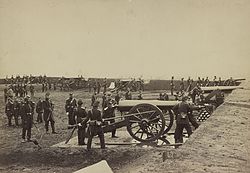
Some of those tales are directly relevant. Others are not as obvious. The Civil War was the mutable factor in why the Virginia component of the original District is so different. Federal Forces moved to occupy the former Federal Enclave west of the Potomac almost immediately, and began to dig.
They encircled the approaches to the Potomac bridges- like the Chain Bridge and the Long Bridge that made landfall near 14th Street with interlocking forts and earthen parapets. Some examples survive, and I often visited them as I started the clockwise trek from the South Stone.
(The Ramparts of Fort Richardson, part of the Arlington Line of the defenses of Washington).
One of the best preserved is Fort Richardson, a redoubt that now encloses the 9th Green of the Blue Course at Army-Navy Country Club.
It is sort of eerie when you are putting there, but maybe it is just me.
Heading northwest from NW3 toward the Potomac there is a dog park the encircles what used to be Fort Ethan Allen’s proud bastion and powder magazine. One of the ramparts remains, if you know what to look at, and an access road now appears to just be a drainage ditch.
Next up is the notorious Ft. Marcy, just south of Rt. 123 on the Parkway, a well-preserved earthen fort where White House legal counsel Vince Foster’s body was found, overlooked and protected the Chain Bridge.
If you visit the fort in the winter when the foliage is thin, you can find outlying redoubts and follow the ghost roads and sniper trenches into comfortable homes built around the Parkway. Ft Marcy came within a whisker of being bulldozed out of existence- a trend common to many other relics of the Late Unpleasantness between the States as development caught fire after the riots downtown that followed the assassination of Dr. King in 1968. There are even some remarkable artifacts of the War left in the District, but we will have to get to them in due time.
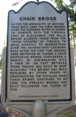
Meanwhile, I was breaking new ground in my quest to visit all the stones. Driving across the modern Chain Bridge, you have to jog south on Canal to get to the left turn at Arizona Ave to get to the next left turn on MacArthur that takes you back north toward the Reservoir compound. Take a left at Norton, and at Potomac Street start looking for a place to park. As an alternate, you can hike or ride a bike on the Capital Crescent Trail (look for the “Entering Montgomery County” sign to let you know you are crossing the demarcation line.
NW 4 is inside the fenced Dalecarlia Water Treatment Plant grounds, 100+ feet east of the Capitol Crescent Trail and several hundred feet north of the intersection of Norton Street and Potomac Avenue. Older sources list the stone’s location as 5906 Dalecarlia Place, but the “government dwelling” that was once there is long gone, and the the street formerly known as Dalecarlia Place has been converted to an access road, so at least there is a place to park if you arrive by car.
The easiest way to see this stone is through the fence along the Crescent Trail because the treatment plant is closed to the public. When I started all this, 9/11 was a recent event, the Pentagon still had the big chunk blow out of the E-Ring, and the system was on high alert.
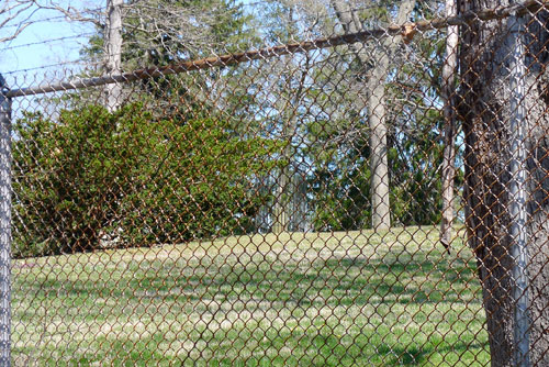
I parked my Sebring convertible in the service drive and peered through the chain link fence. In the middle distance I could see the distinctive cage around what had to be NW4.
As the photo demonstrates, it is not very convincing. Had I seen it? Sort of. I could see the iron fence around it. I was confronted with the first real conflict of the quest. Was I going to accept that as checking the block? Or was I going to have to go for something more. I made a mental note, and walked back to the car to see how difficult trespassing on a Federal Reservation that provides water to the entire city was going to be.
I mean, really. What could go wrong?
Copyright 2016 Vic Socotra
www.vicsocotra.com
Twitter: @jayare303