Stones of the District

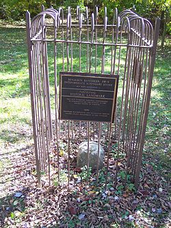
(Curiously, SW9 is the only one of the stones to be a National Historic Landmark. It is named for Benjamin Banneker, and is an “Intermediate Stone,” unlike the four which mark the cardinal points of direction. What is left is a one foot square sandstone block, extending about 18 inches above ground and probably about 2 feet below ground. It was declared a landmark in 1976 after the advocacy of the Afro-American Bicentennial Corporation. Photo DAR).
This tale is going to come together, trust me, but I want to share these words of a novice, writing in 2003 at the beginning of this thirteen year quest. It is going to get a lot more complex, but let’s leave the rookie to find that out for himself, shall we?
Shortly after finishing a story I had not intended to write this morning, I decided to live some life instead of writing about it. I launched for an adventure across the District. I have been doing a little project which was prompted by an old article in the Post a couple years ago, and for which I had not had the time before. But I am a man of leisure now, or at least a man who can set his own agenda for a day off and I did so.
I drove out of the lot at Big Pink at ten, looking for history. I took the GW Parkway past Fort Marcy (where Vince Foster either did or did not blow his brains out) and the George H.W. Bush Center for Intelligence (which shares a campus with the Federal Highway Administration) and onto the Beltway clockwise-bound. Then across the American Legion Bridge at Cabin John and on around the inner loop to pass Bethesda to Georgia Avenue, where the traffic was backed up to the highway waiting to get into the car wash and get the white salt coating off their cars.
It was colder than shit, but clearer than a bell I watched the blacksmith re-forging later on that afternoon in a gentle vale in Arlington. But I am getting out of sequence.
I was headed for one of America’s oldest monuments. Not the oldest, of course, there is a lot of stuff that predates 1792. But this is part of a forty-stone monument chartered by the brand-new Congress of the United States, in accordance with the wishes of the Chief Executive, George Washington.
The stones delineate the boundaries of the newly decreed District of Columbia. I have found and visited the West Stone, in the wilds of suburban Virginia. That part of the District was claimed back by the Old Dominion when the lack of bridges made he arrangement unworkable by the 1840s. It is in the side-yard of a house, in a postage stamp park with bricks that march off to the southeast and northeast that show the old line of United States jurisdiction. The stone is old, laid down in the bramble and trees in 1791 by a straining work crew and directed by a freedman named Bannaker. It is pretty neat that the first monument of the new Republic was surveyed by an African-American, born free in Baltimore.

The South Stone is in what is now Jones Point Park, once a colonial trading post and Civil War hospital and First War Shipyard. Now it is an island of tranquility bounded by the booming of the six-lane disintegrating Wilson Bridge that carries I-95 out of the Dominion and into Maryland. It is in the seawall of the Jones Point Light, itself dating back to 1857. The South Stone is also the First Stone, the first laid according to the wishes of the President who lived down the river at Mount Vernon.
The North Stone is what I found this morning. It is suitably askew, lost on a traffic island in front of a big sign that tells you who the Mayor of the District is at the moment. At one-mile intervals the mile makers are laid with precision.
I drove down the borderline of the real District, Maryland on my right and the capital on my right. There is a stone in Rock Creek Park somewhere, 50 yards in, they say, but I couldn’t find it though I did crash around enthusiastically in the brush for some time. I did find Stone 8 and Seven, both in the front yards of tidy homes on Western Avenue, at 6422 and 5600, respectively.
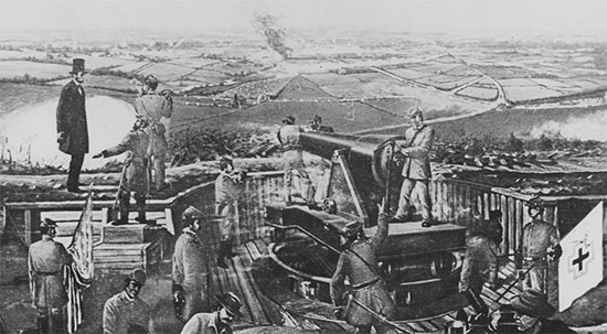
Stone Six is also on Western, just down the slope from the high ground that was Fort Bayard, at the end of Fessenden Street. It is surrounded by a nice fence and with an interpretive sign. The fort is now a city park. It had a commanding field of fire in its time, and I’m sure the troops got a tingle in 1864 on Jubal Early’s Monocacy campaign to capture the Union Capital and force it to come to terms with Southern independence in 1864.

It was the only time in which a sitting President rode to the front lines and exposed himself to fire at Fort Stevens. Mr. Lincoln was grabbed and thrown down by future Supreme Court Justice Oliver Wendell Holmes, a young Union officer at the time.
Early came from the Northwest, out of Maryland, and had he not been slowed up by Union forces at Monocacy Creek, he would have made the District ahead of reinforcements dispatched by US Grant from the assault on Petersburg near Richmond.
Stones Five and Four are lost in the bramble of a reservation with double barbed wire around it in Northwest. I don’t know what it is, but I will find out. It is called the Delcarlia Reservation, and the stones are described as “deep in the woods.” Then a jog south to hook up to Canal Road and back north to cross the Potomac again on the Chain Bridge.
I visited 4013 Tazwell Avenue, but the stone is in the backyard and I did not want to disturb the resident. I would have, but they looked to be home. I managed to catch a glimpse of the cage and stone from the property line, as I did at 5298 Old Dominion. I had one last chance before I hit the West Stone. I drove around some sweeping suburban streets and pulled up to the house at 3607 Powhaten address. I could see the place was empty, closet doors open behind windows with no curtains.
Emboldened, I trespassed. I got to the back yard and looked around. High on the back property, right near the fence line was Stone One, just a mile from the West. It has a fence and a marker and is a place where the owner would use a weed-whacker rather than a lawn mower.
I had a good day. When I got home and poured a cocktail and began to warm up I decided that forts and markers are best found in the dead of winter, before that infernal green comes back.

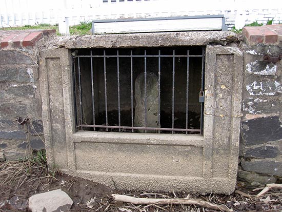
(I had no idea just how challenging this was going to be. Here is a view of the top of SE8, conveniently located on the grounds of the DC impound lot in a very strange part of Anacostia. I have a story to tell you about that.)
Copyright 2015 Vic Socotra
www.vicsocotra.com
Twitteer: @jayare303
